Trailbike rides
- https://www.google.com/maps/d/
- Create map
- Import Garmin open format GPX (waypoints only).
or Google KMZ, which is zipped KML (waypoints, photos, video) - Share map to anyone who has link.
- Embed on my site <iframe>
RBR200723 Trail Bikes – Issues and Challenges.pdf
Mon 22 Dec 2025
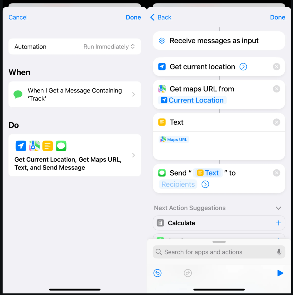
Here’s how to automatically reply with your location to someone sending you a SMS text message containing the keyword ‘where’ or ‘track’ (or similar) on an iPhone. Uses the Shortcuts in-built app.
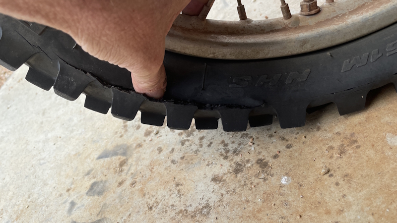
Before: Pirelli Scorpion MX 90/100-16 51M NHS Soft
After: Maxxis MX-ST 90/100-16 Mid/Soft Rear Tyre + Maxxis heavy duty (2.5mm instead of 1.5mm thick rubber) 90/100-16 TR4 TUBE
Sat 20 Dec 2025
Fri 19 Dec 2025
Mon 26 Jan 2026 Australia Day
Sun 22 Mar 2026
This was the ride with Case where I could not make it to the top of Warton’s Lookout on my DR200. It is where Anthony ripped his glove on my luggage carrier pushing my bike.
Sun 29 March 2026
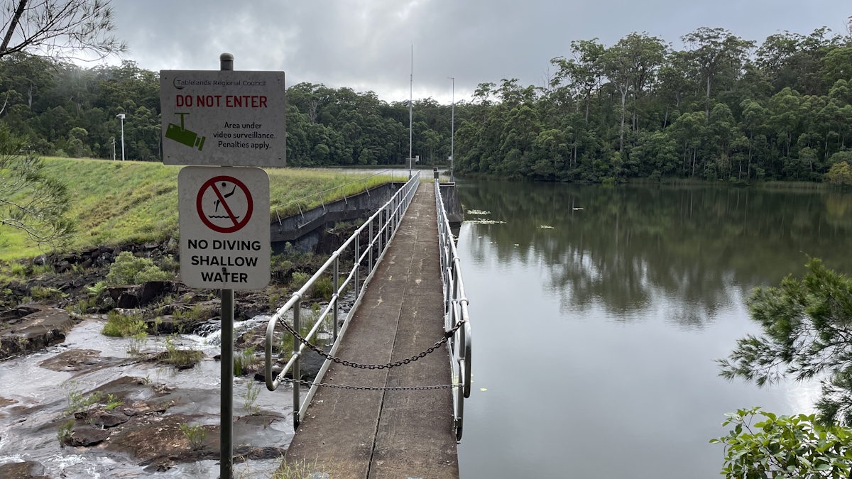
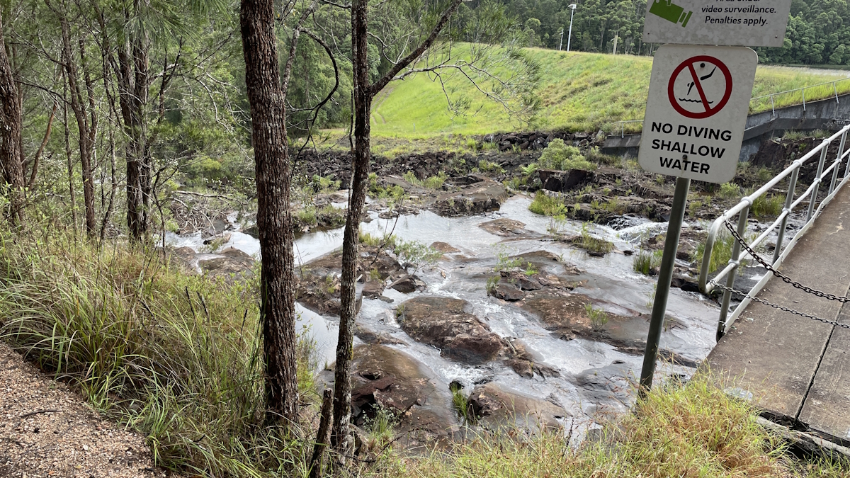
Drover’s lookout. Balance across a narrow concrete dam wall. Massive hill climb where Sophie and I were left to try get back up the hill whilst Anthony and John were exploring a difficult track after just having come down it.
Sun 12 April 2026
Also, rescue mission Zack & Vera. Next day we started from Atherton Mountainbike Park parking entrance, which is Rifle Range Road passing mountain bike trails 1 to 9, all the way up to a clearing called ‘threeways’. If you turn left you continue Rifle Range Road to top of Herberton range. If you turn right (and then further down turn left) you go to mount Wallum where they got stuck in a washout boghole. Later that week we revisited and tried to connect to threeways from Herberton range entrance but it was wet and slippery.
Sun 3 May 2026
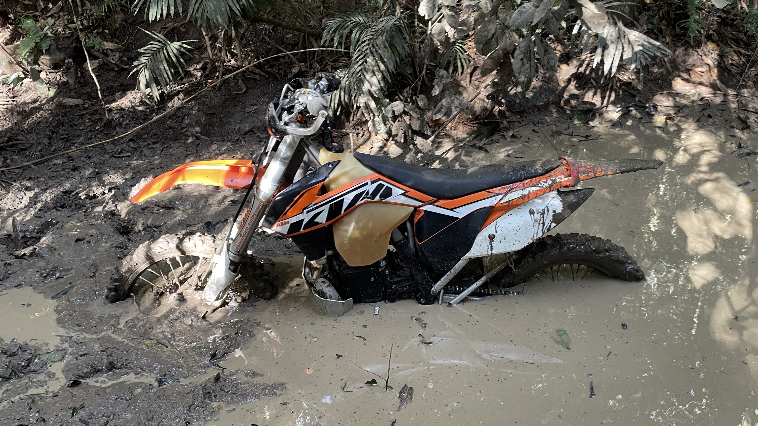
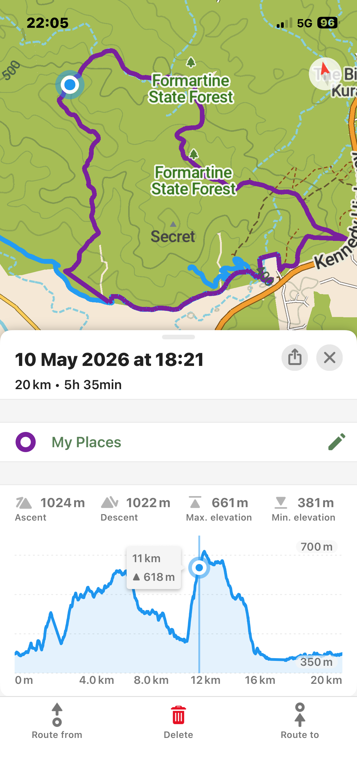
Sun 10 May 2026
We had to leave behind a CRF125F as the chain got bunched up behind the front sprocket. Ran out of daylight and trail disappeared 2kms from base. 3 meter drop into creek bed, slide bikes under 1 meter gap of fallen gum tree, and cross 1 meter deep water hole with split rock climb. Respect. Also best 2nd attempt hill climb ever.
Sun 17 May 2026
Anthony joined us to retrieve bike. Cut a short 100m trail to connect to dead end trail that ended near the creek bed. Did last week’s run in reverse. Got stuck on treeroot step-up halfway on steep hill, as well as rolled back on soft black soil in dense shrubbery where trail took unexpected left hand uphill turn.
Sat 23 May 2026
Speewah. Same trail as last week. Good practice. Gnarly long climb going left around a tree at the top. Made it almost to the top. Then second gnarly bit with drop into creek bed and then steep rocky climb. Met up with these guys who joined. Got stuck in same spots as last week.
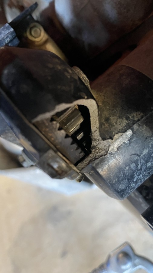
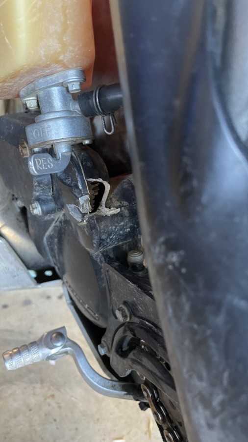
Sun 31 May 2026
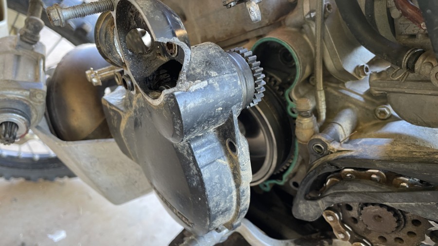
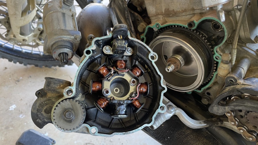
Ride with John, Sophie, Anthony. When I came home I noticed this:
Sat 6 Jun 2026
Parts had not arrived in time. Also need to get bronze bushings kit (3, often come as 4, two short, two long). Little bit of Loctite to prevent spinning in hole.
So took the DR200. You don’t need tools if your bike IS the tools. Today was a good day. Fork leak, oil leak, needs new clutch, needs controls bolted back on bike, lost safety glasses. “If it’s leaking oil, it’s got oil.”
Sun 14 Jun 2026
Vera joined ride and decided it was not for her. We went up and down the fire trail a few times. Broke clutch lever on her bike. Luckily had brought a spare. In the next week I fixed exhaust hanger missing bolt, leak at exhaust manifold (2x new rings), welded cracks in bash plate, installed new bolts for bashplate. Ordered front wheel bearings and installed clutch lever (wrong model was ordered).
Sun 21 Jun 2026
Ride with Anthony in Herberton forest. Made it up Wharton’s Lookout woohoo. Skidded out on wet slippery granite rockface. Fell down at loose rubble steep long climb. Something hit near inner side left leg/knee area. Could be knee brace hinge or just a rock. Ducked to go underneath fallen tree but did not duck enough to account for helmet. Great ride, muscle ache in arms and legs and few other places.