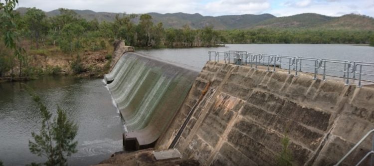
Collin’s Weir motorbike ride
Sat 16 Mar 2019
Download as [*.kmz] file for use in Google Earth
The plan was to drive to Watsonville from Collin’s Weir. The GPS coordinates show where you leave the bitumen at Springmount Road. I was by myself and brought water, canned fruit and phone charger in small backpack. GPS tracker was uploading to website so my partner could find me in case of problems. Road was badly corrugated. No phone reception. It was HOT today. QTOPO maps on my phone did not show any tracks past Collin’s Weir. Looked around and the track I should have taken was closed by a farm gate. Have a look at Google maps (switch to normal map view instead of satellite images). Map shows various bush tracks but you can’t download this for offline use easily. If there was someone with me I would have liked to keep driving. Perhaps next time I will start from the Watsonville / Irvinebank end and see how far we get. Corrogation is no fun though !
I found this video of some guys who did it on dirt bikes 11 years ago 🙂